So back in August last year I wrote a post on the subject “Tsunami Warning: Indoor Maps“. In it I opined that for the last 30-40 years the mapping world has been missing something.
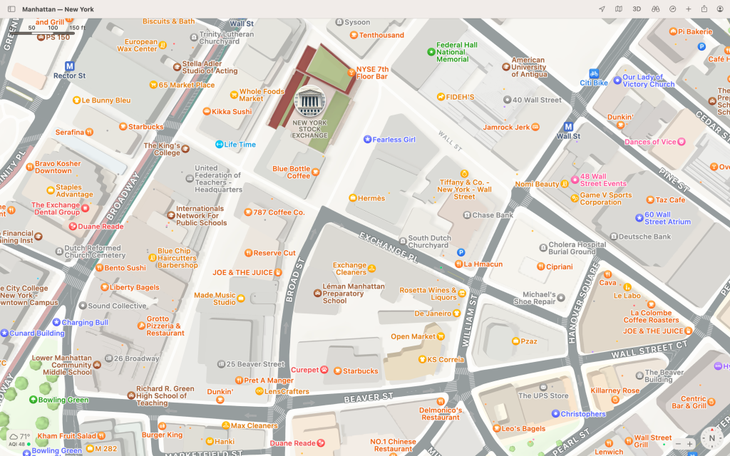
99% of the attention has been on mapping the outdoors and scant little attention has been paid to mapping indoors. As a consequence if you look at practically any popular map you’ll see it is peppered with little black holes — those black holes representing the many millions of building footprints around the world.
And the boundary of every building footprint is like its own little event horizon: dare to cross the threshold and practically all information is seemingly lost.


So why bother with indoor maps in the first place?
Well please humo[u]r me for a moment while I posit this conjecture:
I put it to you that in just a few years not having an indoor map of your buildings or facilities will be like not having a high speed data connection. Just like outdoor maps play a vital role, these smart and interactive indoor maps will bring their own unique value, providing:
- Building layouts and indoor directions for visitors and staff
- Invaluable life saving information for first responders
- Critical information to enable highly efficient building operations & facilities maintenance
- A platform for a whole new category of software: indoor analytics — so you can optimize everything going on inside your facilities — e.g. for resource placement, energy consumption or cost management.
So if that’s the case, why don’t we see an abundance of interactive indoor maps?
Well truth be told, creating an indoor map isn’t easy. Take it from me — I was intimately involved with the indoor mapping program at Apple Maps for many years. We learned — the hard way — that making indoor maps is no piece of cake. It’s actually at least two pieces of cake, if not a whole tower of cakes.
The main cost and complexity is involved with converting building floorplans from the format known and loved by building architects — typically something called ‘CAD’ files and more recently ‘BIM’ files — to a geospatial format. Commonly it has generally meant digitizing floorpans using overly complex geospatial tools that are expensive, hard to learn and even harder to master.
And once you had laboriously created your indoor map it was generally another mountain of work to publish it and share it with others.
And — if you wanted indoor navigation with that — ha! That involved a whole other set of challenges requiring even more machination and grinding of teeth.
So, it’s hard, really hard.
That is up until now.
For about the last 6 years I’ve been following a little company that’s been active in this space and I’ve always been impressed by their work. So much so – full disclosure – back in January I happily accepted their invitation to join their board.
Their name is Mappedin and this week they announced something that is really quite groundbreaking and — to borrow from Apple’s parlance — I think you’re going to love it.
It’s called ‘Maker’.
Maker allows you to take a floorplan and in just a few minutes create an interactive map from it. And with just one more click you can share it with others. But it’s not just an interactive map. The map automatically includes indoor directions.
And here’s the kicker:
‘Maker’ is free.
Yup. You heard that right.
So now any organization can create a map of their building in minutes and publish it as they see fit for the benefit of others.
The process is quite easy:
- Visit Mappedin.com and register
- Drag in your floorplans (e.g. from squared-up photos of the evacuation maps already displayed in your building)
- Locate the floorplan on a street map and align it with the building outline
- Using Maker’s intuitive web interface, digitize the floorplans or try Mappedin’s “Beta” version of “AutoMap”1
- Click the “Preview” button to experience the interactive map before you publish it
- When you’re happy, share the link or embed the map in your site
Here’s how you place the floorplan on the map:
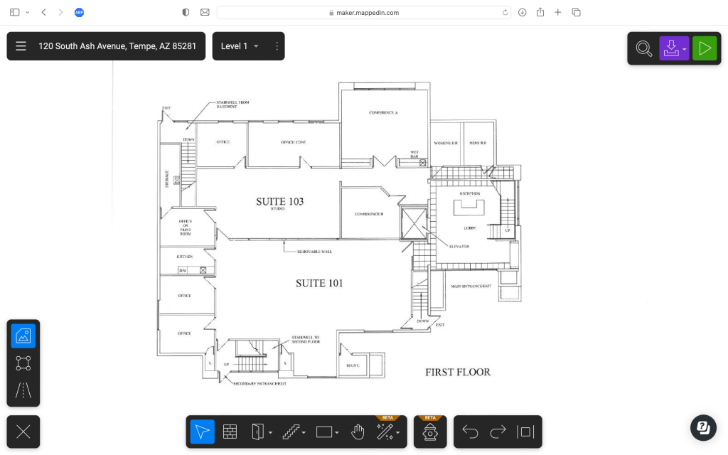
This is what a floorplan looks like in Maker after you’ve uploaded it and before you’ve made it into an interactive map:

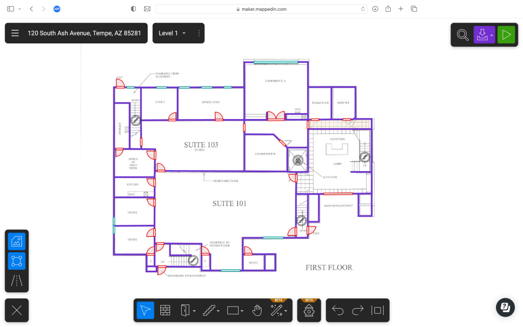
And this is after it has been digitized using Maker’s ‘AutoMap’ feature and about 5-10 minutes of further tweaking:

And this is previewing the interactive map before publishing:
And here’s a video of the published map in action, complete with indoor directions:
I would have embedded the interactive map in this page, but the folks at WordPress want an extra $300 per year from me for the privilege. Instead I’ll have to trouble you to click on a link: you can view the exact same interactive map here.
One cool hidden extra, when you share a link of a Mappedin map with someone, Maker is smart enough to maintain the state of the map. Here’s an example of sharing the same map above just after getting directions from the lobby to the conference room.
So here we are in 2023 and despite what I said on September 14, it turns out map making can be easy after all. 😱
Of course you’ll have to draw your own conclusions, but I would have to say that Mappedin’s Maker is the bee’s knees2 of indoor mapping platforms.
- Providing you start with a reasonably high resolution floor plan with decent contrast this will auto-digitize the floor plan. Given it uses AI and machine learning, Mappedin expects it to get better with time. ↩︎
- “The Bee’s Knees” is actually a Prohibition-era cocktail made with gin, fresh lemon juice, and honey. It is served shaken and chilled, often with a lemon twist. The name comes from Prohibition-era slang meaning “the best”. When describing something that is “the best” the British prefer to use the term “The Dog’s Bollocks”. That particular term comes from the not uncommon habit of male dogs licking their testicles (a.k.a. bollocks) — the theory being that they must be good as they spend so much time performing this act. So you could either call Mappedin’s Maker “The Bee’s Knees” or “The Dog’s Bollocks”. Either one works just as well. ↩︎
