Those Views from Above…
To all of you young whippersnappers that take your many ‘entitlements’ way too much for granted: you simply have no inkling of just how lucky you are. To name just a few:
- The interweb
- Pervasive Wi-Fi (or ‘whiff-ee’ as those suffering from Frenchness have a habit of calling it)
- More than 128K of RAM or 1MB of storage space
- Abundant electricity
- Indoor loos
In my day we had it tough. We were lucky to have a cup of tea — and a cup of cold tea at that.
For those of us curmudgeons who’ve been in the mapping business for a while we should add one key item to this list: it’s the luxurious abundance of “views from above” … otherwise known as aerial imagery.
Aerial imagery has changed how we see the world, it’s changed the way we map the world and it’s changed the way we understand the world.
Many of you will know that back in 1985 as a young lad I worked on the team that pioneered the world’s first in-car navigation system, the Etak Navigator. The Navigator was nothing without its digital street maps, and because no one else had created them we had to make the maps ourselves.
This was not a trivial task. There was no Google Earth. There were no satellite views. And aerial photos were about as scarce as seeing a progressive at a MAGA rally.
To make our digital maps we had to make do with something called USGS Quads — printed maps at 1:24,000 scale that had been made by the US Geological Survey. Some of these maps were relatively new and had been created in the last year, and some of them, well — let’s just say they were a little long in the tooth — and were about 30 years old.
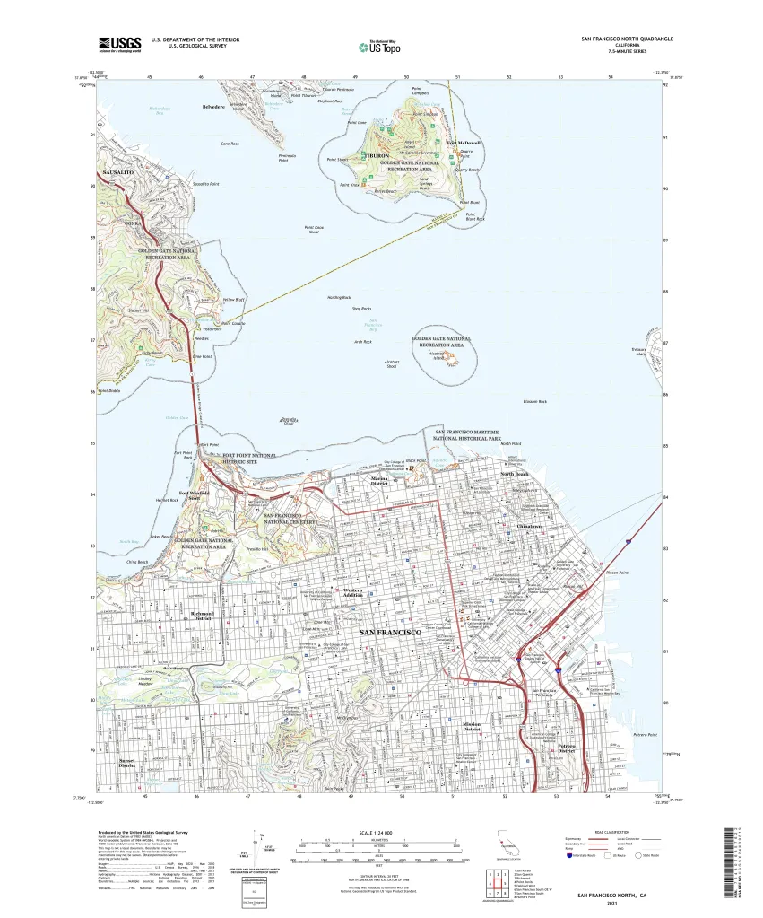
So the digital maps we created were far from being up-to-date. And we knew that. So much so that when we gave people the opportunity to challenge our address finder we always asked them “Where did you grow up?” rather than “Where do you live?”, knowing that we had a much better chance of getting the first question correct. 😜
So where did all these views from above emanate?
Well, the first known aerial photograph was taken in 1858 by French photographer and balloonist, Gaspar Felix Tournachon, a.k.a “Nadar”. And, clever chap, in 1855 he patented the idea of using aerial photographs for mapmaking.
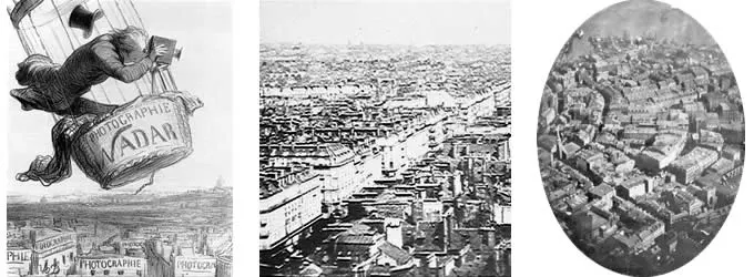
Credit: Professional Aerial Photographers Association (PAPA)
But photographs weren’t only taken from balloons. No, ingenious people also used kites and even pigeons. In fact in 1903 in Bavaria they even established the Bavarian Pigeon Corps for aerial reconnaissance. Managing flight paths proved to be a somewhat interesting challenge, however.
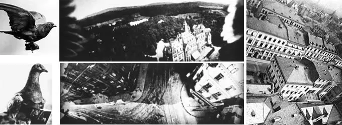
Credit: Professional Aerial Photographers Association (PAPA)
It was none other than a rather famous fellow called Alfred Nobel that took things to the next level in 1897. He produced the first successful aerial photograph from a rocket mounted camera.
But all this was before planes and, perhaps not surprisingly it was Mr. Wilbur Wright who took the first photograph from an airplane (in Italy!) in 1909.
As is often the case it was warfare that accelerated progress. First in World War I, where aerial photography quickly replaced sketching and drawing by people in planes. By the end of this war both sides were taking pictures of the battle fronts at least twice per day.
It was Sherman Mills Fairchild (1896-1971) who we should thank more than anyone for making the greatest advancements.
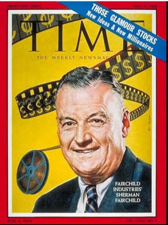
Credit: Time Magazine
Alas, in our world of 21st century high tech, Sherman Fairchild has unfortunately become a rather forgotten hero.
Over the years Sherman Fairchild founded over 70 companies and they became famous for their focus on aviation, cameras and semiconductors.
For those of you that know how to use a rotary dial phone you might have heard of a famous Silicon Valley company called Fairchild Semiconductor. Sherman founded the company in 1957 and it became a pioneer in the manufacturing of transistors and integrated circuits.
Probably what you don’t know is that Fairchild Semiconductor started as a division of Fairchild Camera and Instrument, itself established in 1927.
Dig deeper and you’ll find a story behind this company too:
In 1917 Sherman Fairchild had been rejected from serving in the military due to his poor health. Determined to find another way to support the war effort he went to Washington and won a government contract to develop an improved aerial camera.
His secret sauce: a camera specially designed for use in airplanes where stability and shutter speed remained a problem. By the end of the war Sherman had developed a camera with the shutter located inside the lens. This significantly improved the image quality and became the standard for aerial camera systems over the next 50 years.
In 1921 Fairchild Aerial Surveys started a commercial program to perform aerial surveys of cities and on August 4, 1921 the company produced a series of 100 aerial photographs of Manhattan at an altitude of 10,000 feet:

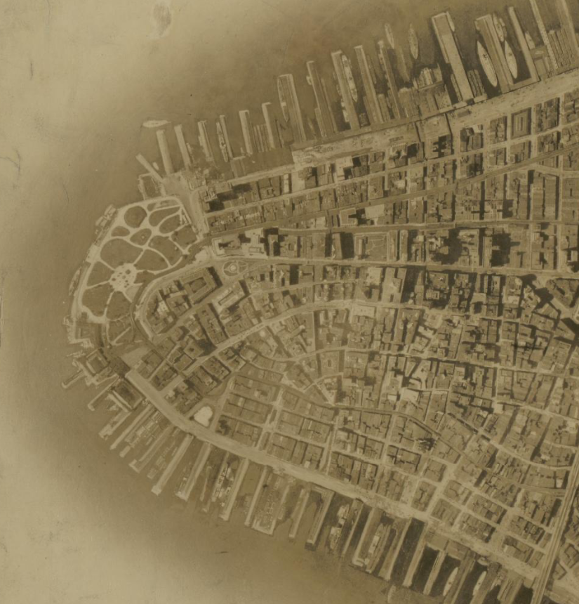
By World War II over 90% of the aerial cameras used by the allied forces were designed or made by Fairchild.
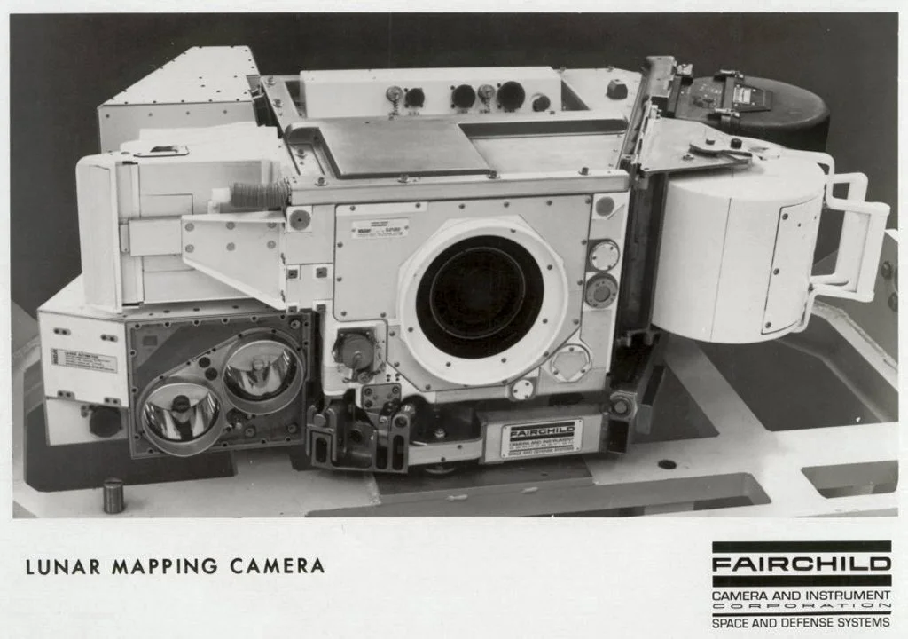
Here’s the clincher: before Fairchild died in 1971, he saw his cameras carried on Apollo 15, 16, and 17, and while astronauts explored the lunar surface, his cameras mapped the moon from the Command Module:
But of course aerial photography doesn’t just come from planes. With the mad rush induced by the Cold War, it was satellites that came to dominate.
Here the Map Happenings accolade for rocking our world must go to none other than Landsat, a program conceived by NASA in the heady times of taming the atom and going to the moon.
From NASA’s history of the project:
In 1965, director of the U.S. Geological Survey (USGS), William Pecora, proposed the idea of a remote sensing satellite program to gather facts about the natural resources of our planet.
Pecora stated that the program was “conceived in 1966 largely as a direct result of the demonstrated utility of the Mercury and Gemini orbital photography to Earth resource studies.” While weather satellites had been monitoring Earth’s atmosphere since 1960 and were largely considered useful, there was no appreciation of terrain data from space until the mid-1960s.
After various political and military push backs NASA was eventually given the go-ahead to build the satellite in 1970. Within just two years, Landsat 1 was launched, heralding a new age of remote sensing of land from space:
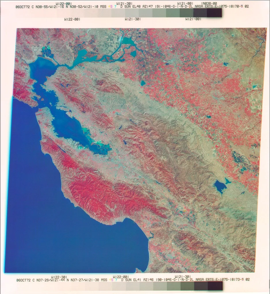
And it’s never been the same since…
If you want a great overview of what’s happened over the years, particularly in the world of satellites, then spend 20 minutes watching this very engaging video from my good friend, Max Lenormand, publisher of MindsBehindMaps:
Satellite imagery has revolutionized the world in many ways — for weather, for agriculture, for environmental studies and of course for the military — but perhaps the most profound way it has affected all of us is for its use in map making.
Without today’s copious abundance of high resolution aerial imagery there is no way the likes of map makers like Google, Apple, HERE, TomTom, Grab, Baidu, KakaoMap and Yandex could do what they do — not only to make their maps, but to keep them up-to-date.
Today companies like Maxar, Planet and Satellogic commonly provide photographic imagery with resolutions as small as 30 centimeters (~1 foot).
The resolution is not limited by technology. It’s limited by governments. No doubt military satellites are capable of single digit centimeter resolution.
But let’s not assume it’s still all coming from satellites. Aerial imagery from planes and drones is still extremely common and companies like Nearmap make a business out of selling imagery that’s “sharper than the best satellite imagery”.
It’s clear that Google and Apple perform their own surveys too. Here’s one of the many aerial screensavers that you’ll find in Apple’s macOS and tvOS:
Of course, there is just one fly in the ointment…
Yes, it’s called clouds.
Oh, and that thing called nighttime too.
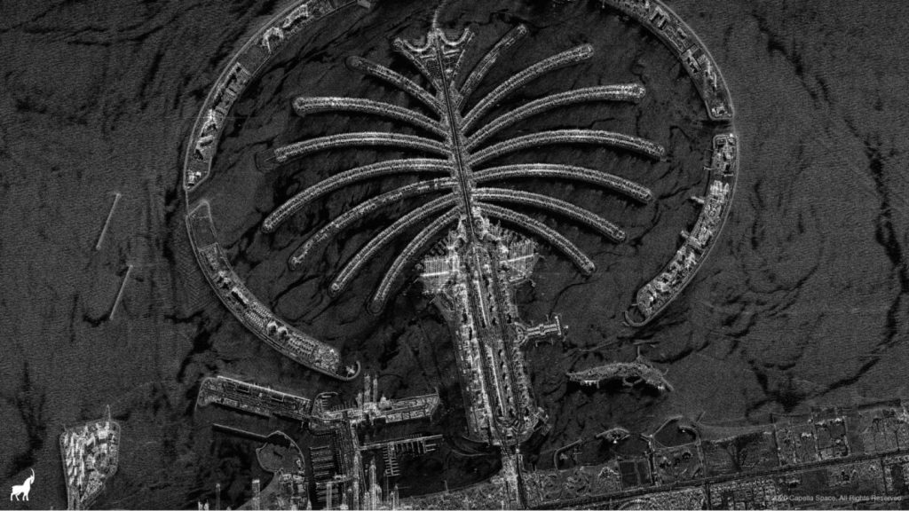
But fear not, dear reader, there’s a solution for that too. It’s something called ‘SAR’ or Synthetic Aperture Radar. Invented by Carl Wiley at the Goodyear Aircraft Company in Arizona in 1951, SAR uses radar to see through clouds (and darkness) to enable high resolution imagery at any time and in any weather.
It was first used in the SR-71 Blackbird spy plane which entered service in 1966 — amazingly some 58 years ago!
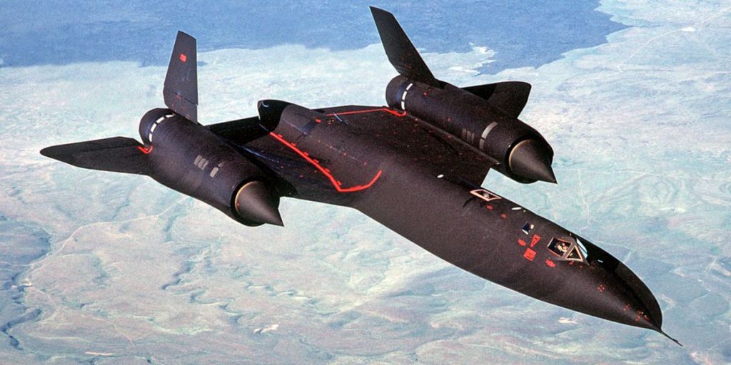
Now SAR images are readily commercially available from companies like Capella Space:
So when you’re next looking at a modern map — any modern map — think about how it was made and how it has been kept up-to-date. None of it would have been possible without those views from above.
Acknowledgments
- Professional Aerial Photographers Association (PAPA)
- US Library of Congress
- NASA
- Wikimedia
- Popular Mechanics Magazine
- Time Magazine
- Capella Space
- Apple
- Max Lenormand
