The Epic Quest for Longitude
Let me start by making one thing crystal clear: this story is about one of civilization’s most epic quests.
And, being the learned reader I’m sure you are, you may already be familiar with it. But even if you are, I encourage you to read on as I will attempt to provide a slightly different perspective to this amazing tale.
I’d like you to join me in a journey back to the early 1700s and, to be specific, the year 1707.
1707 was the year of the Scilly Naval Disaster which involved the wreckage of four British warships off the Isles of Scilly in severe weather. It is thought that up to 2,000 sailors may have lost their lives, making it one of the worst maritime disasters in British naval history1. The disaster was likely caused by a number of factors, but one of them was the ship’s navigators inability to accurately calculate their locations. Had they been able to determine their position they might not have run aground and disaster might have been averted.
But knowing your location at sea wasn’t just about avoiding catastrophes. It was also about money. At this time it was very clear that any nation that could solve this problem could rule the economies of the world.
The French and the British certainly knew this full well. Observatories were built in Paris and Greenwich2 with the primary purpose of determining whether it was possible to calculate your location at sea by viewing the location of stars and the moon.
So let’s start with the basic question: without the luxury of modern technology like GPS, just how could you determine your location in the year 1707?
As I’m sure you know, location is all about coordinates, and specifically about measuring your latitude (how far north or south you are) and your longitude (how far east or west you are).
Before the advent of satellite based positioning systems in late 20th century, the method for determining your latitude and longitude was horribly complex. Furthermore, it was far easier to determine your location on land than it was at sea.
At sea a process of ‘dead reckoning’ was commonly used. Starting from a known location on land, for example a port, one could measure your direction of travel and your speed. By plotting these movements on a map you could continually update your location. Your direction of travel was measured using a compass and your speed was measured using a device called a ‘log and line’:
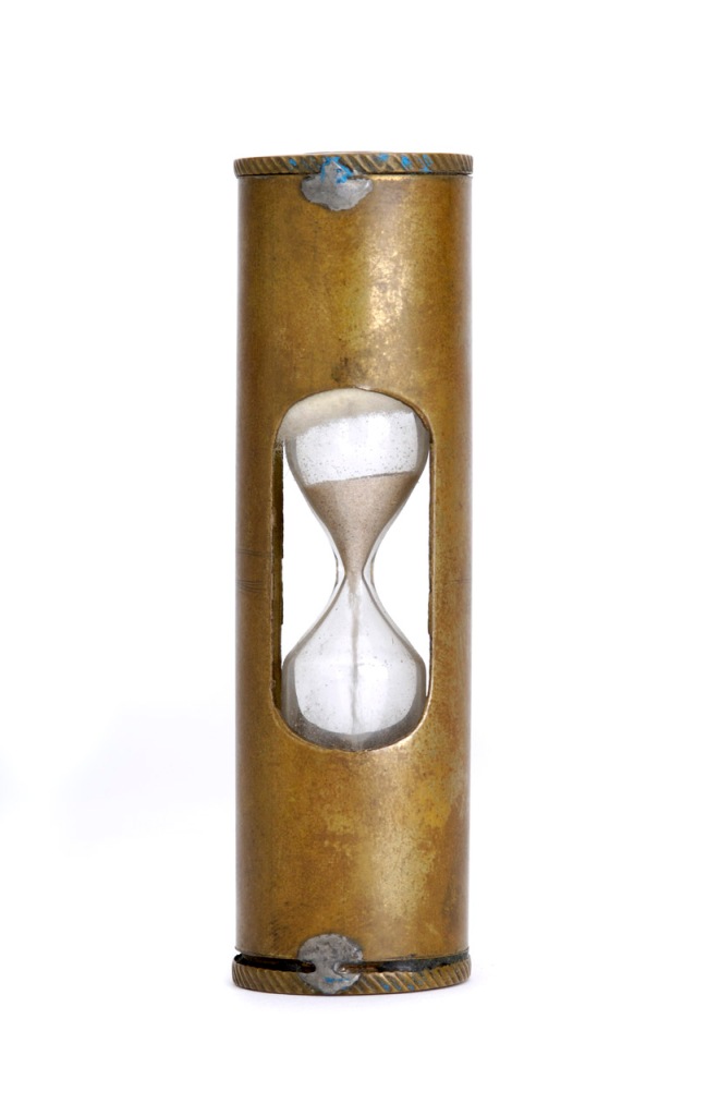
A triangle of wood, called a log, was attached to a knotted line of rope. The knots in the rope were tied at a distance of 47 feet 3 inches. The log was thrown overboard and the speed of the ship was measured by counting the the number of knots that passed through the sailors fingers in the time it took for a 28 second sandglass to empty. This would thus give the speed of the ship in knots — also known as nautical miles per hour3.
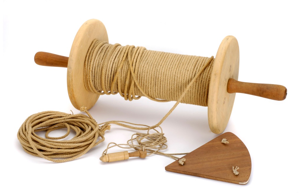
Credit: Royal Museums Greenwich
However, the use of a log and line did not give an exact speed measure. The navigator had to take into account:
- The flow of the sea relative to the ship
- The effect of currents
- The stretch of the rope
- The inaccuracy in the time measurement as changes in temperature and humidity affected the accuracy of the sandglass
Even the compass had flaws — it measured magnetic north, not true north.
Therein lies the issue of the dead reckoning. Errors in any dead reckoning system build up and over time and after a while you no longer have a good idea of your position. To eliminate the error you have to reestablish your precise location using some alternate method4.
In the early 1700s the method for determining your latitude wasn’t easy, but it was possible:
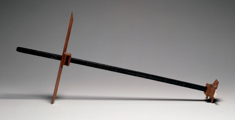
Navigators knew that the height of the sun above the horizon was different according to how far north you were. At noon on the equator the sun was very high (more or less directly overhead) whereas at noon in the more northerly latitudes the sun was much lower. By measuring the height of the sun at noon — not easy in a ship rolling on the ocean waves — you could determine your latitude. This was done using an instrument called a cross-staff5 — although at your peril. The instrument could easily bruise you in the eye as the ship rocked and you might also be blinded as you stared at the sun. But you could measure it. Just. To get a more accurate reading you also needed to refer to complex tables, also known as ‘almanacs’, that you used to adjust your measurements to take into account the tilt of the earth and the time of year6.
At night, assuming it is cloudless, it is also possible to measure latitude by measuring the angle to the North star.
Measuring latitude was difficult but possible — but in comparison to measuring longitude it was easy peasy. The issue at the time of the Scilly Naval Disaster in 1707 was that no reliable method to measure longitude had been devised.
Let’s pause for a moment and compare the problem of accurately measuring your longitude to the problems our world faces today. Perhaps it would be equivalent to the problem of creating a cheap and reliable fusion reactor? The impact of both solutions on society are equally huge.
Solving the longitude problem ultimately helped prevent disasters, enabled global travel and, more importantly, bootstrapped global trade. Solving the problem of generating energy using a fusion reactor would similarly help prevent (climate) disasters, boost global production efficiency (through cheap energy) and boost global trade.
Nations at the time knew how critical it was to solve the longitude problem. In the hopes of finding a solution they used the carrot of large prizes, not dissimilar to the Lunar XPRIZE that Google established in 2007.
Spain tried it first by offering one in the mid 1500s. In the 1600s Holland offered a similar prize. During this time many inventors tried to solve the longitude problem, but no one figured it out.
Such was the ongoing public outcry from the Scilly Naval Disaster and the continued concern of seafaring folk that in 1714 a petition was presented to the British parliament. They encouraged the British government to offer its own prize to solve the longitude problem.
The matter was referred to a group of esteemed experts, including Sir Isaac Newton. In July 1714, on the advice of these experts, parliament adopted “An Act for Providing a Publick Reward for such Person or Persons as shall Discover the Longitude at Sea.”
If you’d like to read the original text of this now famous act, commonly known as ‘The Longitude Act’, and learn more about its passage I suggest you visit this link on the Royal Observatory Greenwich’s website.
As part of the act, parliament created a committee to address the problem and consider any submissions. This committee became known as the ‘Longitude Board’.
The Longitude Board essentially became a VC and was authorized to fund research via grants. More importantly it was authorized to offer a prize to the first person to develop a method for determining longitude to within varying degrees of accuracy:
- £10,000 for an accuracy of one degree (60 nautical miles at the equator)
- £15,000 for an accuracy of two-thirds of a degree (40 nautical miles at the equator)
- £20,000 for an accuracy of one-half of a degree (30 nautical miles at the equator)
The full prize was a significant sum — well over $6,000,000 in today’s money and certainly in the same realm as the Google Lunar XPRIZE which was $30,000,000.
The race was on.
And it all came down to one thing: measuring time.
In principle calculating longitude was easy:
- The earth rotates 360 degrees everyday
- There are 360 degrees of longitude (from -180 degrees to +180 degrees)
- There are 24×60 = 1,440 minutes in a day
- Therefore the earth rotates one degree of longitude every 4 minutes (= 1,440 / 360)
To calculate your longitude all you need to do is determine what time it was at a known location when it’s noon at your current location.
So if you determine it’s 12.20pm in Greenwich when it’s noon at your location then you must be at 5 degrees west:
- Your clock is 20 minutes later than the time in Greenwich
- 20 minutes divided by 4 degrees of rotation per minute = 5 degrees.
Similarly if you determine it is 11.40am in Greenwich when it’s noon at your location then you must be at 5 degrees east.
Simple right?
Noon was easy to measure: it occurs when the sun is at its highest point in the sky. It’s the other part that turned out to be a bitch.
How do you know what time it is in, say, Greenwich, when it’s noon at your location? Give someone in Greenwich a call on your iPhone? Sorry — even if you did magically happen upon such a fruity device — there was still no cell coverage out at sea. Sucker!
So you needed another method to determine the current time at a remote known location.
In 1714 when the Longitude prize was enacted there were three main methods that became contenders for measuring longitude7:
- The ‘Moons of Jupiter’ method
- The ‘Lunar Distance’ method
- The ‘Chronometer’ method
The Moons of Jupiter method relied on a discovery by Galileo in 1612: the orbits of Jupiter’s moons were like clockwork. They always passed in front of Jupiter at a particular time of day at a particular location.
Galileo developed a somewhat complex mechanical instrument called a jovilabe to calculate the time from the positions of the moons. He also suggested the use of a rather scary helmet, called a celatone, to be used to measure the position of the moons:
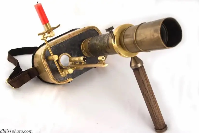
Using a telescope or one of these celatones you could see the positions of Jupiter’s moons. Then referring to some predefined tables and charts you could determine what time this corresponded to at a particular location, for example, back in Greenwich.
Bingo! Problem solved!
Indeed this method proved to be very successful, but not for everyone:
A disciple of Galileo, the Italian astronomer Cassini, realized that the ‘Moons of Jupiter’ method could be used to make more accurate land maps. In 1671 King Louis XIV employed Cassini to revise the existing maps of France. As a result of Cassini’s intricate work the land mass of France in the new maps got reduced by about 20 percent. When the King first saw the maps he is said to have exclaimed “I have just lost more territory to my astronomers than to all my enemies!”
Unfortunately there were a few teeny, tiny problems that made this method somewhat challenging at sea:
- Clouds
- Jupiter isn’t always above the horizon
- Bright daylight!
- Err, ships tend to roll a bit
As a result the ‘Moons of Jupiter’ method was never seriously considered for use by mariners.
The ‘Lunar Distance’ method was first suggested by the Italian explorer, Amerigo Vespucci8, in 1499. The method depends on the motion of the moon relative to other celestial bodies.
The moon completes a circuit of the sky (360 degrees) in 27.3 days on average (a lunar month), giving a movement of just 0.55 degrees per hour. But it’s complicated:
- To be successful a very accurate angle of measurement of the moon’s position was required — if your measurement was off by, say, 0.1 degrees, then your time measurement would be off by about 11 minutes. As a result your calculation for longitude would be off by almost 3 degrees9. In order to win the full £20,000 prize your measurement of longitude had to be accurate to 0.5 degrees. This in turn meant that your measurement of the moon’s position had to be accurate to within 0.018 degrees!
- There’s the issue that you needed access to complex tables and astronomical charts that would tell you the expected position of the moon against the celestial background at some point in the future. To determine your longitude those tables and charts had to be accurate too.
- Having the all the necessary accurate measurements, tables and charts didn’t provide an immediate answer. Further calculations were required and those calculations were long and laborious. Sometimes it would take up to four hours to perform them.
- Clouds
- The moon isn’t always above the horizon
- Err, yes, ships still rolled
You’d think that the Lunar Distance method would have been dismissed as quickly as the Moons of Jupiter method, but other forces were at work.
One of the main purposes of the observatories built by the French in Paris and the British in Greenwich was to develop the tables and charts required for measuring longitude using the Lunar Distance method. The investment in these observatories and developing these tables was therefore huge. On top of that many experts on the Longitude Board were astronomers, most notably Nevil Maskelyne, who was later to be appointed Astronomer Royal. So you might say that there was a vested interest in the Lunar Distance method and a natural bias towards it. As a consequence the Lunar Distance method was far from dismissed and continued to curry favor for many years to come.
So that leads to our last contender. The ‘Chronometer’ method.
The idea behind the Chronometer method was simple: before leaving your port, you set your clock or watch to the known time at that location. You then took that chronometer with you on your trip. Then, when you’re out in the middle of the ocean, simply refer to the time on this chronometer when it’s noon at your current location. From the difference in time you can quickly and simply calculate your longitude from the knowledge that the earth rotates at four degrees per minute.
The problem of course with the Chronometer method was that in early 1700s no clock or watch existed that could keep time accurately.
The detailed rules for winning the Longitude Prize stipulated that the method be able to determine Longitude accurately after a voyage from Britain to the West Indies. This journey took six weeks by ship. So to win the full £20,000 using the Chronometer method your time measuring instrument needed to be accurate to 2 minutes after six weeks which was less than 3 seconds a day. Even a good watch at that time might gain or lose as much as 15 minutes a day!
Needless to say the Longitude Board was extremely skeptical that the Chronometer method would ever be a viable solution. Sir Issac Newton’s point of view didn’t help:
“I have told the world oftener than once that longitude is not to be found by watchmakers but by the ablest astronomers. I am unwilling to meddle with any other method than the right one.”
But is was then that our hero came into view.
His name was John Harrison.
Harrison was a carpenter and lived in the small village of Barrow-on-Humber in the north of England. He had neither been schooled at university nor had he ever gone to sea. But in 1714, at the young age of 20, clock making had become his passion. He was absolutely obsessed with accuracy and had never heard Newton’s doubtful words.
Harrison knew that many factors effected the accuracy of clocks, including humidity, temperature and changes in atmospheric pressure.
Even in his early days of clock making Harrison was a pioneer:
- He knew mechanical friction was the enemy of accuracy, but he also knew that 18th century lubricants were awful. So he invented an oil-free wooden clock by building the most critical parts of lignum vitae, a wood that contained natural lubricating oils.
- He invented a mechanism called the grasshopper escapement which eliminated sliding friction and gave the clock’s pendulum periodic pushes it needed to keep it swinging.
- To measure the accuracy of his clocks, Harrison timed their ticks to the apparent movement of stars from the backdrop of his bedroom window frame to the chimney on his neighbor’s house.
- To develop a pendulum whose length would not be affected by temperature he invented the ‘gridiron pendulum’ which was made from wires of brass and iron. The difference in the thermal expansion rates of the two metals compensated for each other, so the pendulum stayed the same length regardless of temperature.
One of Harrison’s early clocks, ‘Precision Pendulum Clock Number 2’, built by Harrison and his brother in 1722 is still in use today. And it still keeps good time 300 years later: it is accurate to within a second a month. In the early 1700s that level of accuracy was simply unheard of.
On Permanent Display at Leeds City Museum in England — Credit: City of Leeds
While this clock could have easily met the requirements for measuring longitude it could only have done so on land. The rocking of the ship would have wreaked havoc on the pendulum.
But by 1730 Harrison thought he could solve all the issues associated with accurate timekeeping on a ship. For the first time in his life he ventured to London and managed to get a meeting with none other than Dr. Edmond Halley (famous for predicting the comet that bears his name). Being a member of the Board of Longitude Halley was a vital person to convince. Halley introduced Harrison to London’s most famous clockmaker, George Graham.
Harrison was less than impressed with Graham’s clocks:
“While Mr. Graham proved indeed a fine gentleman, if truth be told, I was taken aback by the poor little feeble motions of his pendulums … the small force they had like creatures sick and inactive. But I, um, commented not on he folly in his watches.”
But look at it this way: here was Harrison, some rural carpenter from the north of England, trying to convince London’s leading clockmaker he had something to show. Graham and Harrison debated for hours. It was Harrison’s work on the temperature compensated pendulum that became a turning point. Graham had struggled with this problem for years and failed.
With Graham convinced that Harrison was indeed someone deserving attention the money started to flow. Graham provided Harrison his ‘Angel round’ and lent him money so he could begin development of his sea clock in earnest. Harrison called it ‘H1’:
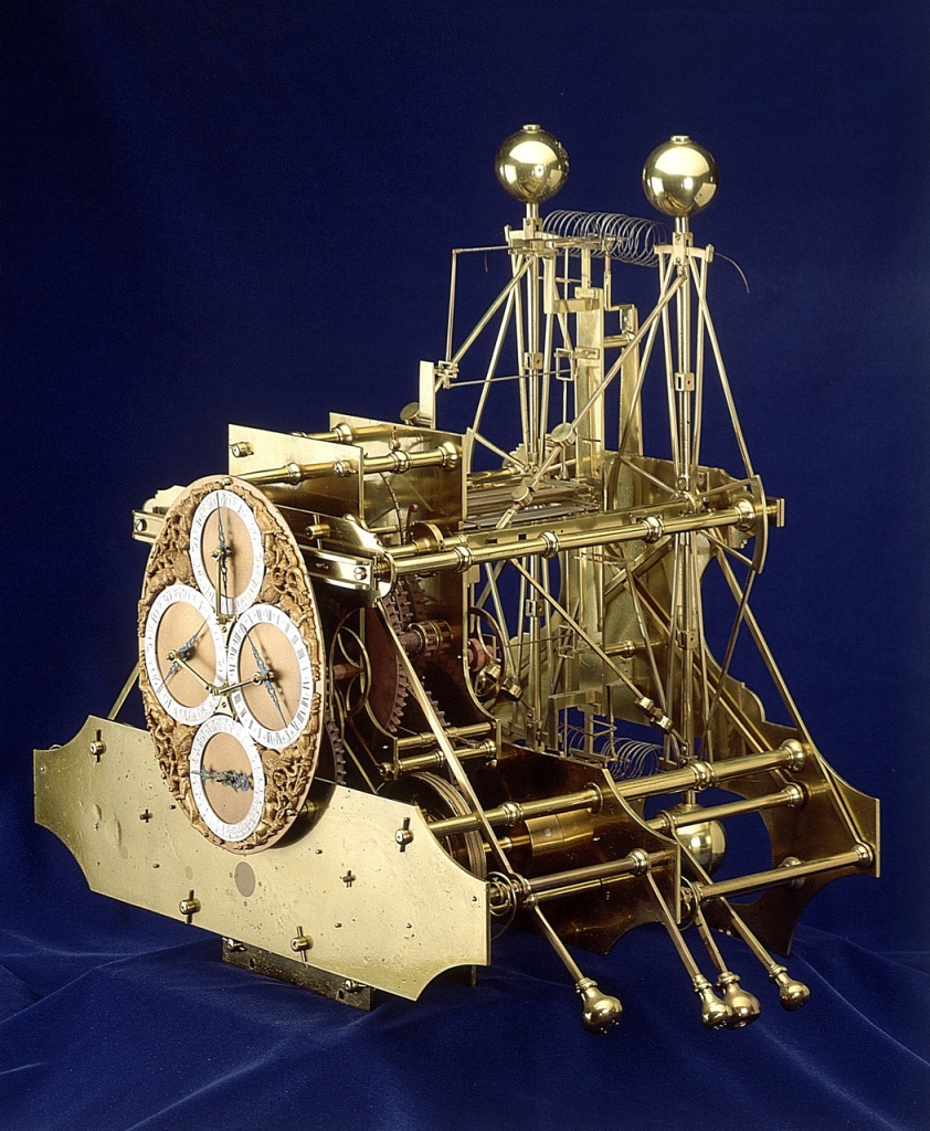
Credit: Royal Museums Greenwich
H1 was a revolution for Harrison. It was the first time he worked with brass. To compensate for the ship’s rocking he switched from using a pendulum to a mechanism using two rocking balance arms. As you can see, it was an intricate instrument. But it worked. In 1736, on a stormy 5 week voyage from London to Lisbon and back, the clock is thought to have been accurate to within 5 to 10 seconds a day. Not enough to win the Longitude Prize, but a huge step forward over anything else.
The Board of Longitude was very impressed. So impressed in fact, that for the first in its 23 years of existence it did something it had never done before: it held a meeting.
Harrison knew H1 was not capable of winning the prize. Instead he petitioned for a round of financing from the Board. The Board agreed and awarded him £500 (~$130,000 today) — but on the condition that H1 and his next development would become the property of the public. He was thus being asked to relinquish his intellectual property. Harrison reluctantly agreed and in 1737 Harrison embarked on his next development, H2:
Credit: Royal Museums Greenwich
H2 was completed in just two years, but Harrison was never satisfied with its design and never allowed it to be tested at sea.
In the meantime the astronomers were not standing still. They continued their work on the Lunar Distance method. It was Nevil Maskelyne, on the Board of Longitude, that became Harrison’s nemesis. Maskelyne, who was educated at Cambridge and was also a priest, is thought to have been pompous and full of himself. Harrison was the uneducated outsider. Maskelyne was the university educated insider. Tough world.
And the Board of Longitude controlled the funds. Harrison became deeply frustrated:
“They said, a clock can be but a clock, and the performance of mine, though nearly to truth itself, must be altogether a deception. I say, for the love of money, these professors or priests have preferred their cumbersome lunar method over what may be had with ease, for certainly Parson Maskelyne would never concern himself in such a matter if money were not bottom … and yet, these university men must be my masters, knowing nothing at all of the matter, farther than that one wheel turns another; my mere clock being not only repugnant to their learning, but also the loss of a booty to them.”
Despite all this Harrison convinced the board to provide further funding that he needed to continue his work. The Board granted it in 1741.
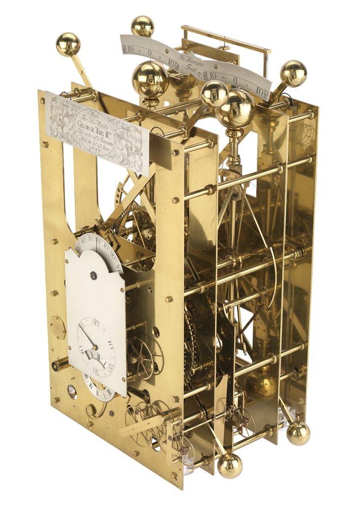
Harrison had promised the Board that his next device, H3, would be completed in two years. But it took him 19. During this time Harrison appeared before the Board nine times. Each time he appealed for more time and more money. He repeatedly missed his promised dates. To me it sounds like a classic VC story — Harrison could easily have been pitching Sand Hill Road. Over this period Harrison received a total of £3,000 (~$1M today).
Credit: Royal Museums Greenwich
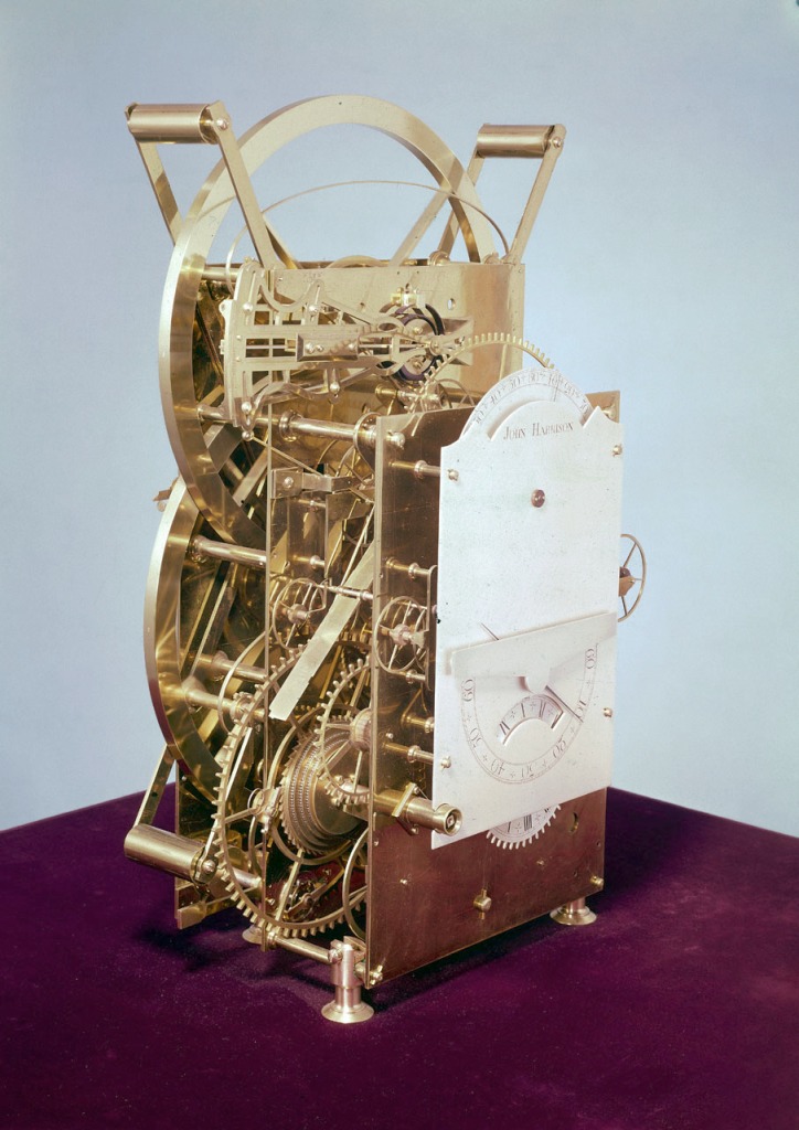
It was while Harrison was developing H3 that Harrison also turned his attention to watches. He was always disparaging of them and was convinced “he could improve these dreadful things called pocket watches”. In 1753 he instructed a watch maker, John Jefferys, to make a watch to his own design. It turned out to be far more accurate than he expected. After 25 years of working on clocks Harrison came to the realization that watches were the way to go. It was a classic ‘pivot’.
At a Board meeting held on July 18, 1760, Harrison declared that his latest clock, H3, was ready for trial. But he also reported that his first watch, which was under construction, would serve as a longitude timekeeper in its own right. He called the watch H4.
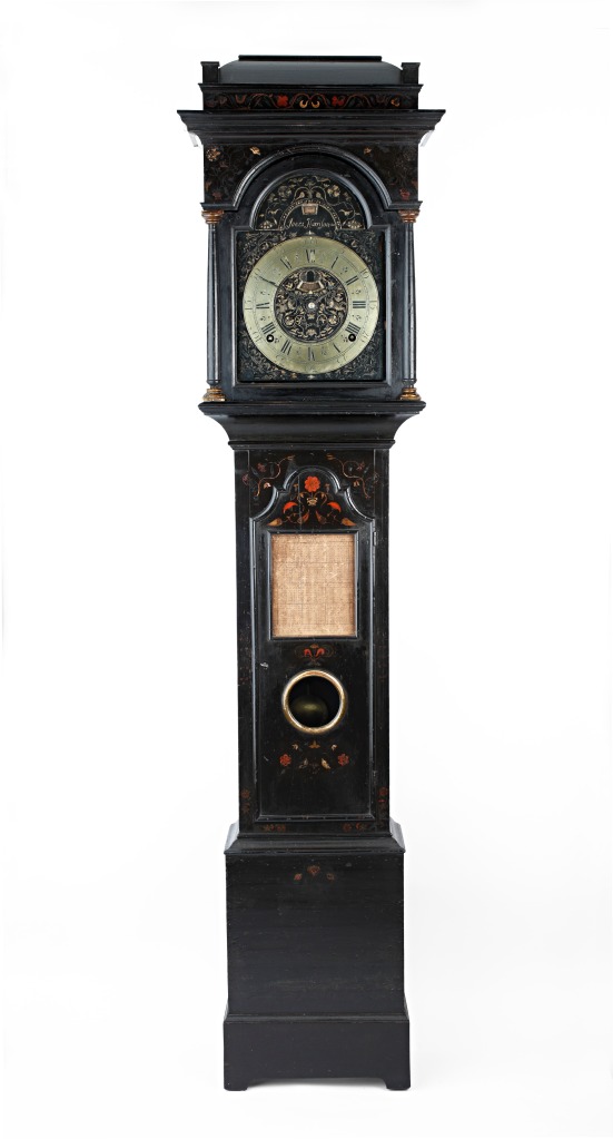
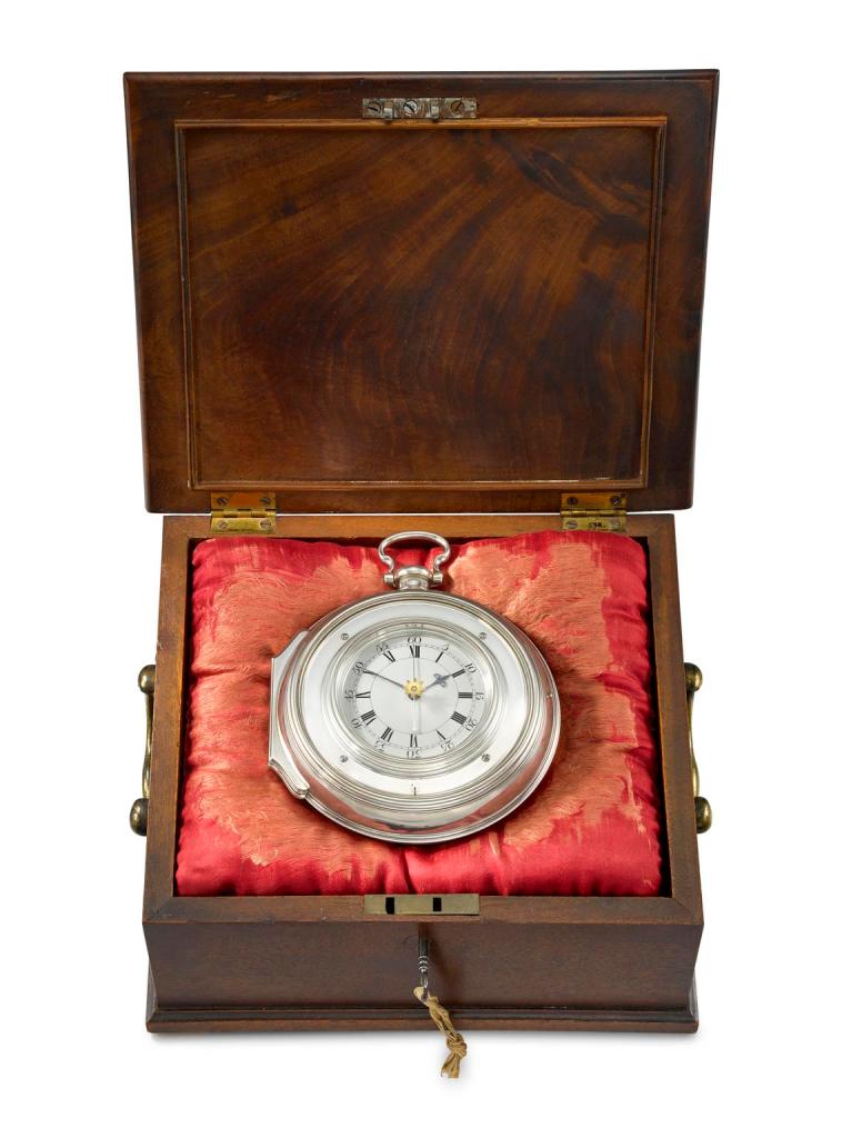
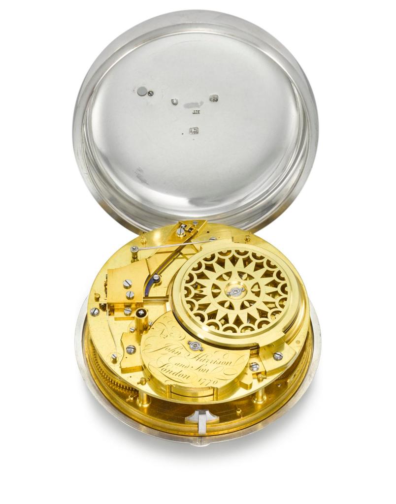
H4 was finally completed in 1759. Harrison was now 66 years old and had worked on his timekeepers for more than 45 years.
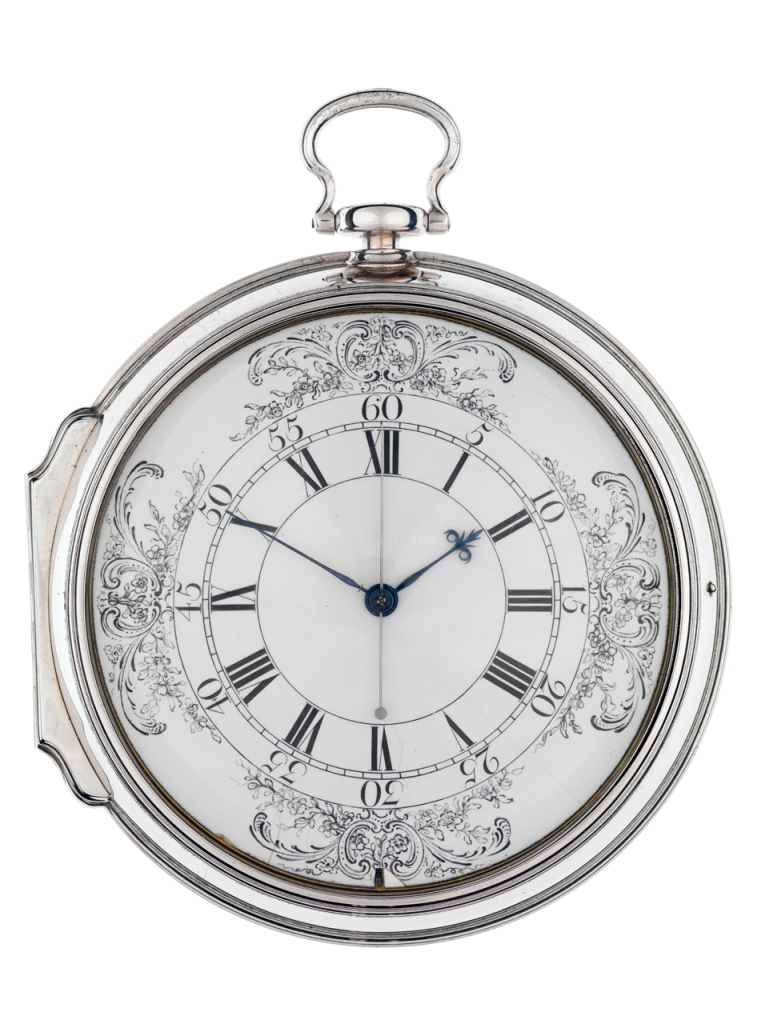
Credit: Royal Museums Greenwich

Credit: Royal Museums Greenwich
On February 26, 1761, Harrison contacted the Board with the request to test both H3 and H4 at sea. But a few months later, apparently dissatisfied with H3, withdraw it from the test. It was down to H4.
But Harrison’s struggles were only just beginning.
Under the terms of the Longitude Act, the first trial was a voyage from Portsmouth, England to Jamaica.
Harrison claimed that H4 lost a mere 5.1 seconds during the eighty-one-day voyage — which was a stunning result and easily enough to meet the requirements for the full £20,000 prize. But his claim depended on an allowance being made for the watch’s natural fixed gain or loss per day, also known as its “rate of going”. The problem, however, was that Harrison neglected to specify H4’s rate of going before the trial. For this reason the Board declared the result of the trial to be non-conclusive. They did, however, agree that H4 had met the terms of Section V of the Longitude Act and that it was “of considerable Use to the Publick”. As such the Board awarded £2,500 (~$725,000 today).
A second trial was scheduled, this time to Barbados, but before it occurred Harrison appealed to Parliament for further monetary assistance, presumably because he had more than exhausted his funds in completing H4. In 1763 Parliament passed “An Act for the Encouragement of John Harrison” which stated that Harrison could receive a prize of £5,000 (~$1.5M today). This award did not require a second sea trial, but instead required that Harrison assign all of his trade secrets and intellectual property associated with the design and engineering of his watch to the public, to the satisfaction of a technical committee. He would not only have to supply detailed designs, but he would also have to dismantle the watch piece by piece before the committee and supervise workmen in making two or more copies of it, which would have to be tested. In other words: sell your soul and we’ll give you $1.5M. Harrison refused and never received any money from the Act.
For the second trial, as for the first trial, the precise longitude at the destination had to be measured prior to its start. It was Harrison’s nemesis, the Very Reverend Nevil Maskelyne, that was selected to take this measurement. He would do so using the ‘Moons of Jupiter’ method.
Much to Harrison’s chagrin, the Longitude Board had also decided that the Lunar Distance method should be tested simultaneously with Harrison’s chronometer. The 1763 Act by Parliament protected Harrison against competitors using the Chronometer method, but not against competitors using the Lunar Distance method. Harrison was therefore extremely troubled.
And the Lunar Distance method was gaining favor. The Board was sufficiently impressed with Maskelyne results that in 1763, it authorized him to produce The British Mariner’s Guide, a handbook for use of the lunar distance method.
As Harrison was getting old, it was Harrison’s son who traveled with H4 to Barbados. When he met Maskelyne he accused him to be “a most improper person”. Maskelyne was not surprisingly extremely offended.
Regardless of the animosity between the Harrisons and the Board, the Board declared H4’s second test to be a success. H4 was able to measure the longitude to Barbados to an accuracy of less than 10 miles — three times better than needed to win the full £20,000 prize.
On February 9, 1765 the Board considered Harrison’s claim to the prize.
Still they did not award it!
The problem, they explained, was in Section IV of the Longitude Act. This section instructed the Board that a method was deemed to have won when it had been “tried and found practicable and useful at Sea.”
The Board told Harrison that he had not explained how his watch had worked, nor had he explained how it could be manufactured at scale so it could be put into general use. Therefore the Board therefore decided that the watch was not “practicable and useful”.
These words turned out to be crucial and it’s a text book lesson in legalese.
Harrison pushed back and continued to claim the full prize. The Board and Harrison both escalated the issue to Parliament. The Board sought to codify its recommendation. Harrison fought back. But the Board won and Harrison lost.
In May 1765, Parliament passed “An Act for explaining and rendering more effectual” its previous Longitude Acts.
To be awarded the first half of the £20,000 prize Harrison would now have to:
- Explain the principles of his watch to the satisfaction of the Board
- Assign the property rights in all four of his timekeepers to the Board
- Hand over all four timekeepers to the Board
The second half of the £20,000 prize would be awarded when “other … Time Keepers of the same Kind shall be made,” and when these other timekeepers, “upon Trial,” were determined by the Board to be capable of finding the longitude within half a degree.
In interpreting the Act the Board decided that Harrison would need to dismantle his watch in front or a technical committee to the satisfaction of the Board. When they explained this to Harrison he declared he would never consent “so long as he had a drop of English blood in his body”.
The Board’s chairman responded thus:
“Sir, … you are the strangest and most obstinate creature that I have ever met with, and, would you do what we want you to do, and which is in your power, I will give you my word to give you the money, if you will but do it.”
Finally Harrison capitulated.
Over six days he dismantled H4 before the Board’s technical committee — and much to Harrison’s disgust Maskelyne was present for the event. But on August 22, 1765 the Board agreed that Harrison had completed the knowledge transfer to their satisfaction. The remaining condition to win the first £10,000 was to hand over his timekeepers. Harrison finally handed them over on October 28, 1765. On the same day he was awarded the first half of the prize.
But what of the second half of the prize?
According to the Act, Harrison would only receive the final payment when “Time Keepers” (plural) “of the same Kind shall be made”. That meant at least two copies of H4 needed to be made. The Board declined to provide funds to Harrison for him to make the copies, instead outsourcing the work to another watchmaker for a fee of £450 (~$120,000 today). For the required trial of the copies the Board introduced scope creep: no longer was it to be a six week voyage to the West Indies, but a 10 month trial at the Royal Observatory and an an eight week voyage.
By this time Harrison was 74 years old and would have to wait at least another year to see the copies of his watch tested. And yet the Board still had not specified what would constitute a successful trial.
Harrison made his own copy of H4 which he called H5. Due to his failing eyesight it took him four and a half years to complete. By that time it was 1772 and Harrison was 79. Rather than submit H5 to the Board Harrison’s son appealed to the King George III. Soon after father and son were granted an audience. The King was clearly taken by the Harrisons’ plea for he declared out loud: “By God, Harrison, I shall see you righted!”
Credit: The Science Museum Group
Credit: The Science Museum Group
While the King was an ally the Board still pushed back. Harrison gave up dealing with the Board and appealed again to Parliament for their benevolence — asking for an appropriate award for his lifetime of work and dedication. Parliament relented and awarded Harrison the sum of £8,750. While this was no doubt welcomed by Harrison it still did not represent the full award and he never received the remaining £1,250.
Even today there are differing and strong opinions on the Board’s decision.
The author Dava Sobel wrote an amazing best selling book on this epic story. It’s called “Longitude”. It is still the number one best seller for books on geography on Amazon. If you’re at all interested in learning more about this tale then this book is an absolute ‘must read’.
Dava takes the position that the Board slighted Harrison and accuses them of bias.
But others have taken a different point of view.
One such view is held by Professor Jonathan Siegel in his excellent paper ‘Law and Longitude’. Jonathan is a professor of law and takes the position that “The Commissioners of Longitude did their duty.” He looks at it from the Board’s point of view, focusing on the meaning of those crucial words in the Longitude Act: the question as to whether Harrison’s invention was “practicable and useful”.
Perhaps you can see the Board’s perspective: H4 and its subsequent copy, H5, took years to build. They had commissioned a third party to make duplicates of H4, but at a cost ~$60,000 a copy in today’s money. And what would happen if your precious and expensive watch were to malfunction at sea? You would be totally lost and there would be no hope for recovery. At least the Lunar Distance method did not suffer this problem.
Was H4 “practicable and useful”?
As you’re considering this perhaps you should consider a present day analogy: let’s say some government had enacted a similar prize for landing humans on the moon and returning them safely to earth. And let’s say the rules for winning used the same benchmark as the 1714 Longitude Act — that it be “practicable and useful”.
Did Apollo 11 meet that criteria? After all it got people safely to the moon and back. But that mission alone cost $2.7B in today’s dollars10. Given a very expensive new rocket had to be built for each mission should it only win half the prize? Or should the full prize only be awarded for a completely reusable rocket?
As to Harrison’s epic quest and whether it was deserving of the full prize, I encourage you to read both Dava’s book and Jonathan’s paper and make your own decision.
In the meantime be thankful that you can simply look at your phone to determine your position — and that you don’t have to spend hours doing laborious calculations or wear one of those scary celatones.
I’ll leave you with one last tidbit:
Centuries after Harrison’s toils, at a dinner at 10 Downing Street, Neil Armstrong, the first man on the moon, proposed a toast to John Harrison, saying his invention enabled men to explore the earth, which gave them the courage to voyage to the Moon.
So was Harrison’s quest a Map Happening that Rocked Our World?
I’ll say so.
Footnotes:
1 This story is documented in the “The Last Voyage of Sir Cloudesley Shovell” by W. E. May. May, W. (1960).
2 England. Not Connecticut.
3 The distance between the knots, 47 feet 3 inches, wasn’t an arbitrary number. It is the distance traveled in 28 seconds if your are moving at a speed of one nautical mile per hour … thus it is your speed in knots. 🙂
4 The Etak Navigator — the pioneering in-vehicle navigation system released in 1985 had the same problem. But its brilliance was to eliminate dead reckoning errors by “map matching” — correcting its position to a topologically accurate map.
5 The sextant, still in use today, wasn’t invented until 1731.
6 At midwinter (21 December) you needed to deduct 23.45º from your reading, and at midsummer (21 June) to add 23.45º. Between those times you had to adjust the readings proportionally.
7 There were plenty of other wacky ideas too. Professor Jonathan Siegal describes some of them in his paper:
“In 1713, William Whiston and Humphrey Ditton, a pair of mathematicians, proposed that a fleet of ships be anchored across the ocean at 600-mile intervals and that each such ship fire off a cannon shell and flare every day at midnight. Navigators of other ships could then determine their position by timing the interval between seeing the flare and hearing the cannon.60 The difficulty of anchoring ships in mid-ocean and the vast expense that would be required to man the ships made this proposal impractical.61 Even more incredible was the plan, proposed in 1687, to send a wounded dog aboard every ship, and to leave behind a discarded bandage from the dog’s wound. Each day at noon, this bandage would be dipped in “powder of sympathy,” a substance which had the miraculous power to heal at a distance, although at the cost of giving some pain to the patient. The dog’s yelp when the bandage was dipped would give the ship’s navigator the necessary time cue.62 Like most plans that rely on magic, however, the powder of sympathy method failed to work in practice.”
8 Amerigo’s main claim to fame: America is named after him.
9 The moon makes a circuit across the sky in 27.3 days = 655.2 hours. A circuit is 360 degrees so that’s ~0.55 degrees per hour. If your measurement of the moon’s position is off by 0.1 degrees then that’s 0.1/0.55 = 0.182 hours = ~11 minutes. The earth rotates at one degree of longitude every four minutes, so 11 minutes is almost 3 degrees of longitude. If you’re at the latitude of London then 3 degrees of longitude is about 210km or about 130 miles. Ouch.
10 Source NASA: Expenditure on the Apollo missions 1968-1972 converted to today’s dollars using CPI Inflation calculator
Acknowledgments:
- Dava Sobel for her best selling book, ‘Longitude‘.
- Professor Jonathan R. Siegel for his superb paper ‘Law and Longitude‘ published in the Tulane Law Review, Vol 84, Number 1, July 2009
- PBS Nova – “Lost at Sea- The Search for Longitude” narrated by Richard Dreyfus (1998). If you can stomach the incessant ads I found a copy of the video here
- The Royal Museums Greenwich
- The Royal Observatory
- The Mariner’s Museum and Park
- Wikimedia and its site, Wikipedia
- Britannica
- The City of Leeds
- The Science Museum Group
- CPI Inflation calculator
Other Reading:
- Open University: Measuring Latitude and Longitude
- Sea Museum: Why Latitude was Easier to Find than Longitude
- The Guardian: John Harrison Vindicated after 250 Years of Absurd Claims
- Guide to London: Where to See John Harrison’s H4
